Why Do So Many Indian Cities Have a “Civil Lines” Area Like Prayagraj, Kanpur, Roorkee, Delhi, Bareilly & Fatehpur?
Discover why Indian cities have Civil Lines, their British-era history, meaning, purpose, and differences from cantonments, with examples from Prayagraj, Kanpur and Delhi.
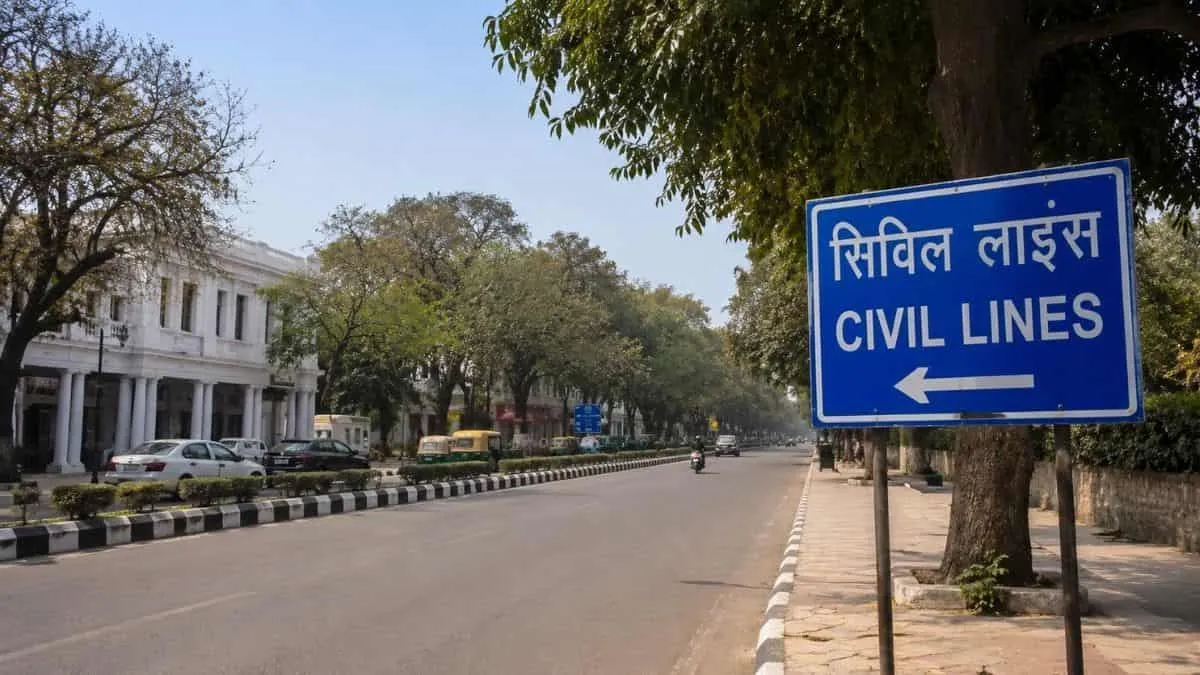
If you ever visit cities such as Prayagraj, Kanpur, Roorkee, Delhi, Bareilly, Fatehpur, and many other Indian cities, you may notice something very interesting.
These Indian cities have "civil lines" areas. But have you ever wondered why it is so? Why Do So Many Indian Cities Have a “Civil Lines” Area? What do civil lines mean, what is the history behind it, and what is usually found in civil areas? Are Civil Lines & Cantonments areas the same, and why are Civil Lines different from old cities?
Explore this article in detail and get to know all the above queries
Why Do So Many Indian Cities Have Civil Lines?
Many Indian cities have “civil lines" because during British times, they inaugurated and developed many cities with separate civil administrative and residential settlements in and around older Indian towns, and many of these areas and their names survived after independence.
What Does “Civil Lines” Mean?
Civil Lines was generally the area where British civilian officers and other European residents lived and worked during the colonial period.
The word “Civil” means the “Civil Administration," not any ordinary citizen, and the “Lines” refers to the colonial period for a certain period of time for planning residential or administrative areas.
In that period, another settlement was also created by the British, and that was "Cantonment," which was mainly related to the "military."
Why Did the British Create Civil Lines?
During the colonial period, the British created the Civil Lines area for the following reasons, which are:
-
Administration
-
After the British gained control over the Indian administration and revenue collection starting from the Battle of Plassey in 1757 and establishing their administrative power with the Battle of Buxar in 1764, they needed proper areas for administration.
-
So, they established the “Civil Lines” areas for District officials, courts and other government offices.
-
Space
-
Usually, older cities are more congested and often densely populated areas.
-
So, for proper space, they could be planned with more open land areas, for their offices, larger compounds, and wider roads.
-
Health & Sanitation
-
Britishers were more concerned about diseases, sanitation, and crowded areas.
-
That’s why they have created fewer covered areas for good health and sanitation.
-
Security
-
After the Revolt of 1857, the British became particularly concerned about protecting European residents and important government and military establishments.
-
The Government of India-linked historical study explains that colonial settlements, including cantonments and civil stations, were often separated from older Indian towns and had specific administrative or military functions.
-
Separate Residential Areas
-
The new areas were also designed to provide a different living environment for European residents and officials.
-
This created a visible difference between many older parts of Indian cities and the newer colonial areas.
What Was Usually Found in a Civil Lines Area?
A Civil Lines area could contain several types of buildings and spaces.
| Common feature | Why it was important |
| Government offices | Administration |
| Bungalows | Residence of officials |
| Wide roads | Easier movement |
| Tree-lined avenues | Planned environment |
| Parks | Open space |
| Churches | Religious needs of European residents |
| Clubs | Social life |
| Schools | Education |
| Courts | Administration and justice |
| Government residences | Housing for officials |
Are Civil Lines & Cantonments areas the same? Civil Lines vs Cantonments
No, they both are different,a nd served for different purposes.
Civil Lines
Mostly connected with:
-
Civil officers
-
Government administration
-
European residential areas
-
Government buildings
-
Bungalows
-
Roads and gardens
Cantonment
Mostly connected with:
-
Soldiers
-
Military barracks
-
Military offices
-
Parade grounds
-
Military hospitals
-
Defence activities
Civil Lines vs Cantonments
| Civil Lines | Cantonment |
| Mainly civilian administration | Mainly military |
| Civil officers | Soldiers and military officers |
| Government offices and residences | Barracks and military facilities |
| Bungalows and offices | Parade grounds and military buildings |
| Connected with civil administration | Connected with defence |
Both were important parts of colonial urban planning, but they were not the same thing.
Why Were Civil Lines Usually Different From the Old City?
One of the easiest ways to understand Civil Lines is to compare it with the older part of a city.
| Feature | Older city | Civil Lines |
| Roads | Often narrow and crowded | Often wider and more planned |
| Houses | Closely built | Larger houses and compounds |
| Open space | Limited in many areas | More open space and gardens |
| Settlement | Dense | More spread out |
| Planning | Developed over a long period | More deliberately planned |
| Main historical connection | Indian urban life | Colonial administration |
How Many Indian Cities Have Civil Lines?
Civil Lines is found in many Indian cities. There is no single official Government of India database giving a complete nationwide count of all cities and towns with a locality called Civil Lines.”
Some well-known examples include:
| No. | City | State |
| 1 | Prayagraj | Uttar Pradesh |
| 2 | Kanpur | Uttar Pradesh |
| 3 | Bareilly | Uttar Pradesh |
| 4 | Roorkee | Uttarakhand |
| 5 | Delhi | Delhi |
| 6 | Budaun | Uttar Pradesh |
| 7 | Jabalpur | Madhya Pradesh |
| 8 | Jaipur | Rajasthan |
| 9 | Jhansi | Uttar Pradesh |
| 10 | Moradabad | Uttar Pradesh |
| 11 | Nagpur | Maharashtra |
Why Is Prayagraj's Civil Lines So Famous?
The official Prayagraj district website records that the British period began in the city in 1801, when the Nawab of Oudh ceded the territory to the British. It also records the city's later importance as an administrative centre.
The city later became an important centre of British administration.
A judgment available through the official Allahabad High Court website also describes the present Civil Lines area as having developed as a Civil Station for civilians during the British period, with government-owned land and large plots.
The official Prayagraj district website also describes Civil Lines as the city's English quarter. It notes that Alfred Park, now Chandra Shekhar Azad Park, was built in 1870 in the heart of this English quarter.
So Prayagraj's civil lines were not simply given a normal name later. Its name is connected with the colonial-era civil settlement that developed there.

Prabhat Mishra is a Subject Matter Expert and digital journalist with an extensive background in the competitive exam landscape and over 4 years of experience in education, national and international news, and current affairs. Over his tenure with top knowledge platforms like Mentorship India, IAS BABA, IAS SARTHI, and now Jagran Josh, he has a deep understanding of government exams like UPSC and State PCS, including UP and Bihar, as he has already qualified for the UPPCS 2022 Mains and Bihar 68th Mains. With his core expertise in history, polity, geography & current affairs, he specialises in creating well-researched, aspirant-centric content and simplifying complex topics for competitive examinations.





![[Out] UGC NET June 2026 Result Live: यूजीसी नेट रिजल्ट ugcnet.nta.nic.in जारी, डायरेक्ट लिंक से करें चेक](https://img.jagranjosh.com/images/2026/August/2782026/UGC-NET-Result-2026-Marksheet-link-pdf.jpg)