Key Points
- Eratosthenes (c. 276-194 BCE) coined 'geography,' meaning 'writing about the Earth.'
- He accurately calculated Earth's circumference using geometry and observations.
- Eratosthenes created a grid system for maps, influencing modern navigation.
Did you know that every time you look at a map or check the weather, you are practising a science that is thousands of years old? Geography is more than just memorising the names of countries.
It is the study of our world, the land beneath our feet, and how humans interact with nature. It helps us understand how mountains form, why oceans move, and how people build cities.
But who was the first person to turn these observations into a real science? Long ago, a brilliant scholar from Ancient Greece chose to map the entire known world.
He was a mathematician and a poet. He even figured out the size of the Earth using just a stick and the sun. He invented the word "geography" that we use today. In this article, we will explore the life and discoveries of this mysterious genius.
ALSO READ| Who Is Known As The Father Of English Literature?
Who is Known as the Father of Geography?
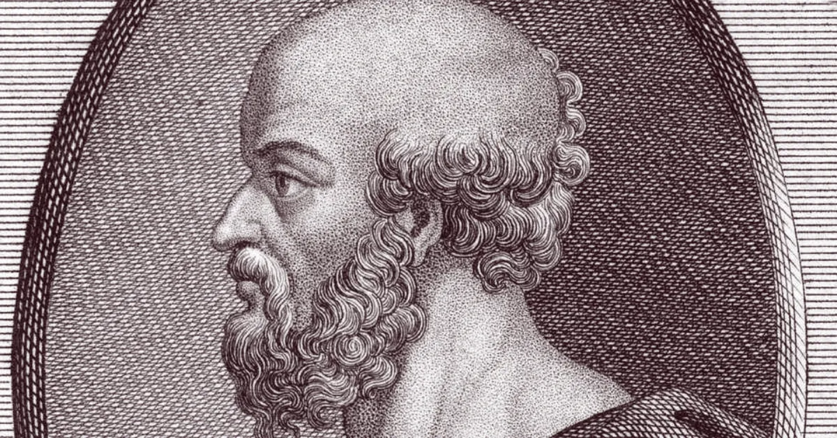
Eratosthenes of Cyrene (c. 276–194 BCE) is widely known as the "Father of Geography". This ancient Greek scholar was the first to use the term "geography".
He calculated the Earth's circumference with impressive accuracy and developed a systematic grid-based approach to mapping the world.
He was a man of many talents. Born in 276 BCE in Cyrene (modern-day Libya), he was much more than just a geographer. He was a mathematician, poet, astronomer, and even a music theorist.
i. The Librarian of Alexandria

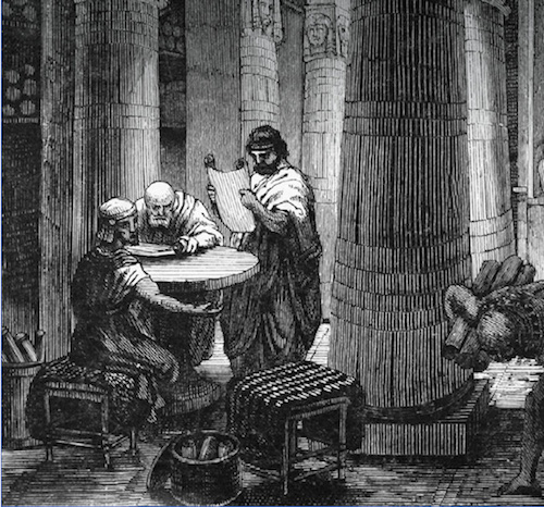
Because he was so brilliant, he was invited to be the head of the Great Library of Alexandria in Egypt. This was the most famous centre of learning in the ancient world.
- A "Beta" Mind: His peers nicknamed him "Beta" (the second letter of the Greek alphabet). This wasn't an insult; it meant he was the second-best in the world at almost everything.
- The First Scientific Geographer: Before him, people told stories about the world. Eratosthenes used maths to prove facts about it.
What Does "Geography" Actually Mean?
We use the word "geography" every day, but Eratosthenes invented it. He put together two Greek words to describe his work:
Breaking Down the Word
- "Geo": This means "the Earth".
- "Graphia": This means "to write" or "to describe".
So, geography literally means "writing about the Earth".
IN CASE YOU MISSED| Who is Known as the Father of Modern Chemistry?
His Contributions to the Field
- The First Map: He created one of the first maps of the world that used a grid system.
- Climate Zones: He divided the Earth into five climate zones: two freezing poles, two temperate zones, and a burning tropical zone in the middle.
- Geography as a Science: He moved geography away from mythology and turned it into a serious branch of mathematics.
Why Eratosthenes Is Known As The Father Of Geography?
:max_bytes(150000):strip_icc()/eratosthenes_photo-5c8d7bcc46e0fb00016ee0b8.jpg)
Source: Thoughts.co
Eratosthenes of Cyrene (c. 276–194 BCE) is known as the "Father of Geography" because he was the first person to use the term "geography" (geographia, meaning "writing about the Earth"). He was also the first to set it up as a separate scientific field, distinct from history or philosophy.
His title is backed by several important contributions that established the basis for modern geographical study.
1. Coining and Defining the Subject
Eratosthenes named the science itself. He also wrote an important three-volume work called Geographika. In this work, he described the known world and listed over 400 cities. This was an impressive achievement in data collection for the ancient world.
2. Measuring the Earth's Circumference
One of his most famous achievements was calculating the Earth's circumference with impressive accuracy using basic geometry.
- Method: He observed that at noon on the summer solstice, the sun was directly overhead in Syene (modern-day Aswan), casting no shadow. At the same time in Alexandria, a vertical rod cast a shadow at an angle of roughly 7.2° (about 1/50th of a full circle).
- Result: By knowing the distance between the two cities, measured by professional surveyors called bematists, he figured out the Earth's full circumference to be about 39,375 km. This is very close to the current measurement of around 40,075 km.
3. Establishing the Grid System
Eratosthenes created a systematic method for map-making by introducing a grid of parallels and meridians, which are latitude and longitude.
This was the first time people could identify specific locations on Earth's surface and measure distances between them, like the distance from the Caspian Sea to Northwest Africa.
4. Classification of Climate Zones
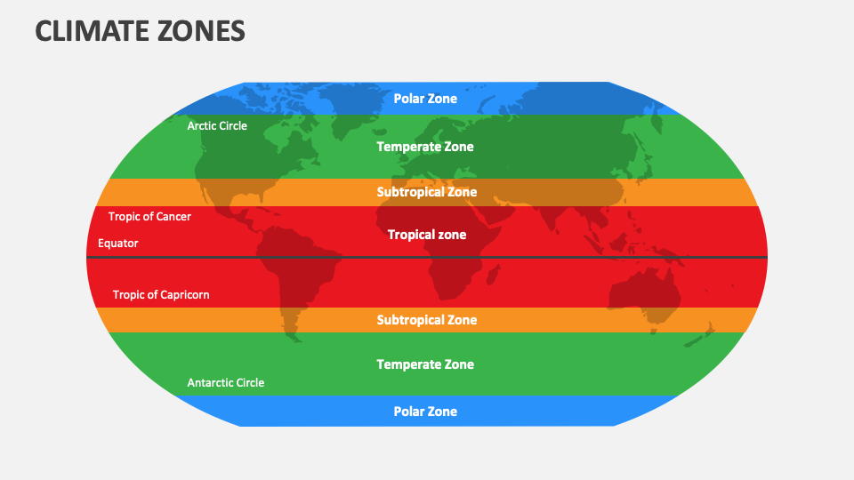
Source: Collidu
He was the first to divide the Earth into five distinct climate zones based on the sun's angle and latitude:
- Two Freezing (Frigid) Zones around the poles.
- Two Temperate Zones.
- One Torrid (Tropical) Zone encompasses the equator.
Why Is He Still Important Today?
Eratosthenes laid the foundation for how we navigate the world today. Every time you use a map on your phone, you are using his ideas.
Key Legacies
- Longitude and Latitude: He was the first to use a system of horizontal and vertical lines to locate places on a map. This evolved into the GPS coordinates we use now.
- The Leap Year: He figured out that a year isn't exactly 365 days and suggested adding an extra day every four years.
- The Earth's Tilt: He calculated the tilt of Earth's axis, known as the obliquity of the ecliptic, with great precision for his time. It was determined to be 23° 51′ 20″. This explains why we experience seasons.
- Mapping the Nile: He clearly outlined the route of the Nile River up to Khartoum. He was the first to correctly propose that heavy rains near the river's source led to the flooding downstream.
Even though he lived over 2,000 years ago, his curiosity and logic changed how humans see their home in the universe.
WHAT'S NEXT| Who Is Known As The Father Of Geometry?


Comments
All Comments (0)
Join the conversation