Which Indian States Share a Border With Nepal?
Which Indian states share a border with Nepal? Know the five states bordering Nepal, their locations and important India-Nepal border facts.
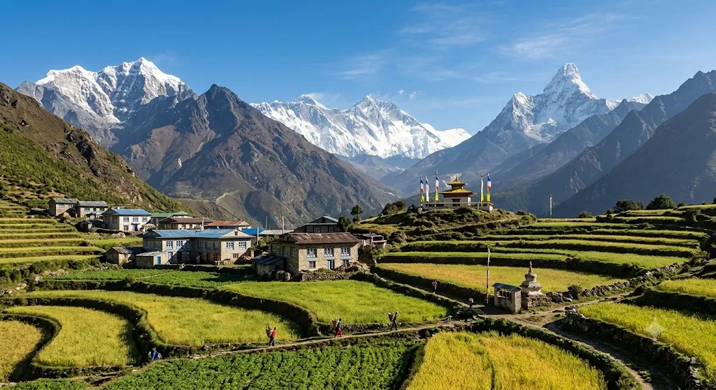
India shares an international land border with several neighbouring countries. Nepal is one of India’s important neighbours in the north. The India-Nepal border is about 1,770 km long. Five Indian states share a border with Nepal. These states are Uttarakhand, Uttar Pradesh, Bihar, West Bengal and Sikkim. Keep reading to know in detail.
Which Indian States Share a Border With Nepal?
The five Indian states sharing a border with Nepal are Uttarakhand, Uttar Pradesh, Bihar, West Bengal and Sikkim. These states are located along India’s northern and northeastern side.
India-Nepal Border States
| Indian State | Location Along Nepal Border | Important Fact |
| Uttarakhand | Western section | Shares border with Nepal and China |
| Uttar Pradesh | Central section | Has a long border with Nepal |
| Bihar | Central-eastern section | Several districts border Nepal |
| West Bengal | Eastern section | Shares border near the Siliguri region |
| Sikkim | Northeastern section | Shares borders with Nepal, Bhutan and China |
1. Uttarakhand
Uttarakhand is one of the Indian states that shares a border with Nepal. It is located in northern India. Nepal lies to the east of the state. The Kali River forms part of the India-Nepal boundary in this region. Uttarakhand also shares an international border with China.
2. Uttar Pradesh
Uttar Pradesh shares a significant portion of India’s border with Nepal. Nepal lies to the north of the state. Several districts of Uttar Pradesh are located along the international border. The border is important for trade and movement between the two countries.
3. Bihar
Bihar is another major Indian state bordering Nepal. Nepal lies to the north of Bihar. Several districts in northern Bihar share the international border. India-Nepal trade is important in several border towns.
4. West Bengal
West Bengal shares India’s border with Nepal in its northern part. Nepal lies to the north of West Bengal. The border is located near the Himalayan foothills. The Siliguri region is an important geographical area close to the Nepal border. West Bengal also shares international borders with Bhutan and Bangladesh.
5. Sikkim
Sikkim is India’s northeastern state that shares a border with Nepal. Nepal lies to the west of Sikkim. Sikkim also shares international borders with Bhutan and China. The state is located in the Himalayas. Kangchenjunga is the world’s third-highest mountain, is located in the region.
How Long Is the India-Nepal Border?
The India-Nepal international border is approximately 1,770 kilometres long. It extends from Uttarakhand in the west to Sikkim in the east.
India-Nepal Border
| Feature | Details |
| Neighbouring country | Nepal |
| Indian states sharing border | 5 |
| States | Uttarakhand, Uttar Pradesh, Bihar, West Bengal, Sikkim |
| Border length | 1,751 km (often rounded to ~1,770 km) |
| Direction | Northern India |
| Type | International land border |
| Major geographical region | Himalayas and Terai |

Jasreet Kaur is a journalist with over 3 years of experience in digital media and news content creation. She specializes in covering Trending News, including major National and International developments, with a focus on delivering accurate, engaging, and reader-friendly stories. Prior to this, she worked with Zee News as a Content Writer, where she gained extensive experience in news reporting and content strategy. Driven by curiosity, credibility, and a passion for impactful journalism, Jasreet aims to contribute to informed public discourse while supporting positive growth in organizations, society, and the world.




![[Out] UGC NET June 2026 Result Live: यूजीसी नेट रिजल्ट ugcnet.nta.nic.in जारी, डायरेक्ट लिंक से करें चेक](https://img.jagranjosh.com/images/2026/August/2782026/UGC-NET-Result-2026-Marksheet-link-pdf.jpg)