Why Google Maps and Apple Maps Renamed Lake Ontario to Lake America
Tech platforms Google Maps and Apple Maps have updated their labeling to display Lake Ontario as Lake America for users inside the United States. The change reflects updates made to the federal database following an executive order signed by President Donald Trump.
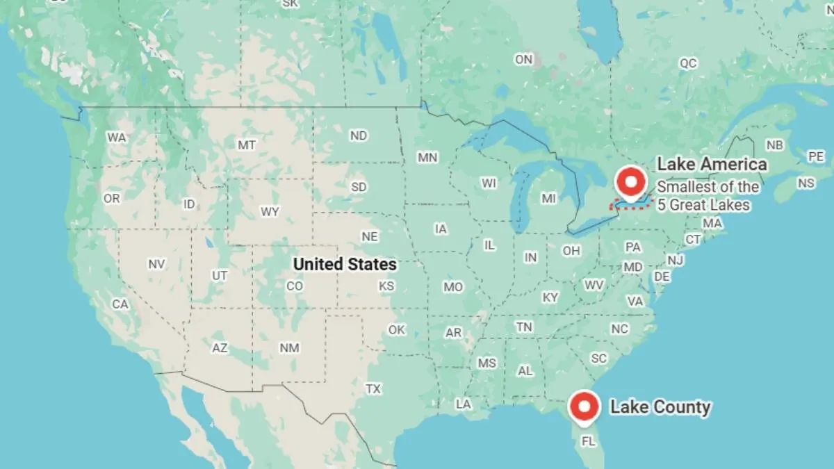
The way Google Maps and Apple Maps represent one of the largest lakes of North America is changing. Lake America has replaced the traditional name of Lake Ontario on both the maps for users of the United States.
The adjustment follows an executive order which was signed on August 27 2026 by President Donald Trump to implement a subsequent update to official federal database records. Americans now see the Lake Ontario as Lake America from August 29 - 30 2026. But Canadian users of Google and Apple Maps continue to see the old name of the water body.
Let’s read more about how tech platforms handle diplomatic and cartographic disagreements across international borders through this latest name change example.
Why Google Maps and Apple Maps Renamed Lake Ontario to Lake America
This renaming happened because the US Geographic Names Information System (GNIS) which is the official database maintained by the US Geological Survey officially revised its entry.
Map companies usually get updates from government records directly to remain compliant with local laws.
In an official statement regarding the platform's mapping protocols Google noted:
"Since we update Google Maps to reflect name changes in official government sources, which is GNIS for the US, people using Maps in the US will see 'Lake America,' those in Canada will continue to see 'Lake Ontario,' and those outside of the US and Canada will see both names."
How the Geographic Names Information System (GNIS) Lake Ontario/Lake America name change in the US will appear on Google Maps pic.twitter.com/nFw80TwaqH
— News from Google (@NewsFromGoogle) August 30, 2026
Mapping software serves region specific data based on user location. And the label displayed changes depending on where the Google and Apple app is accessed.
| User Location on Maps | Display Name Shown |
| Lake America | |
| Canada | Lake Ontario |
| Rest of the World | Lake Ontario (Lake America) |
Ontario Premier Doug Ford publicly addressed the rename on ABC's This Week. They caled the unilateral change absolutely backwards and noted that local communities on both sides of the border continue using the historical designation.
How Digital Maps Handle Geopolitical and Border Name Changes
Digital mapping software relies on automated feeds from national cartographic authorities to remain compliant with local regulations.
When a sovereign government alters a place name within its official registry mapping providers update their databases to match the national standards of the user's IP location.
-
Systems detect the user's connection origin to render local official terminology.
-
Shared natural borders often display dual names outside the involved jurisdictions to maintain balance.
-
Local search indices usually keep former names active in the background. This allows directions to function whether a user searches for the historic or updated name.
This localised system ensures mapping services remain legally compliant within individual countries while preserving historical geographic names for international users.

Harshita Singh is an education and general knowledge journalist with over 5 years of experience in educational writing. Specializing in US affairs and GK, Harshita has a track record of breaking down intricate geopolitical and historical subjects into clear, digestible insights for learners. Her strong background in text analysis, coupled with a Bachelor of Arts (Hons) in English from the University of Delhi, helps her produce authoritative, thoroughly researched content that empowers readers to engage confidently with global current affairs. For inquiries or academic insights, you can reach out to her directly at harshita.singh@jagrannewmedia.com.






![[Out] UGC NET June 2026 Result Live: यूजीसी नेट रिजल्ट ugcnet.nta.nic.in जारी, डायरेक्ट लिंक से करें चेक](https://img.jagranjosh.com/images/2026/August/2782026/UGC-NET-Result-2026-Marksheet-link-pdf.jpg)