According to the National Hydrographic Office (NHO) in coordination with Survey of India (SoI), the new length of Indian coastline has been revised from 7,516.6 km to 11,098.81 km.
It is bordered by the Arabian Sea on the west, the Bay of Bengal on the east, and the Indian Ocean to the south. India shares its sea borders with several countries, such as Sri Lanka, Indonesia, and the Maldives.
There are nine states and four union territories with a coastline. Talking about which state has the longest coastline, the title is earned by Gujarat, which has a coastline of 2,340.62 km; however, can you take a guess which state or UT has the shortest coastline?
Looking at the Old Coastlines data, the coastlines of Goa and Daman & Diu were combined. As a result, it was only counted once for Goa (160.50 km), giving the state the shortest coastline.
However, according to the NHO's latest data, Goa and Daman & Diu now have different coastlines, i.e., 193.95 km and 54.38 km, respectively. Therefore, the Daman & Diu union territory has the shortest coastline stretching about 54.38 km.
India also has island groups, such as the Andaman and Nicobar Islands and Lakshadweep. In this article, we will explore what makes each coastal state and territory unique.
ALSO READ| Which State has the Longest Coastline in India?
Updated India Coastal Data (2026)
| Category | Updated Data |
| Total Length of Coastline | 11,098.81 km (New 2025 Official Figure) |
| Total Land Area | 3,287,263 km² |
| Area of Continental Shelf | Approx. 372,424 km² |
| Territorial Sea (up to 12 nm) | 193,834 km² |
| Exclusive Economic Zone (EEZ) | Approx. 2.30 million km² |
| Population (Coastal States/UTs) | Approx. 600 million (2026 Projection) |
| Population (Island Territories) | Approx. 0.45 million |
> Coastline Type (Mainland)
These percentages represent the physical makeup of India’s shores:
- Sandy Beach: 43%
- Muddy Flats: 36%
- Rocky Coast: 11%
- Marshy Coast: 10%
> Coastal Erosion Data
Sea levels and storms continue to impact the coast. According to the National Centre for Coastal Research (NCCR):
- Mainland Erosion: Over 1,624 km is currently affected.
- Island Erosion: About 132 km of island shoreline is vulnerable.
List of Coastal States & UTs of India

Source:PWOnlyIAS
In April 2025, India updated the official length of its coastline. The government used advanced satellite mapping to measure every part of the shore.
This new information will help improve planning for ports, security, and disaster management. The updated list and details for each coastal state and territory are provided below.
India's Revised Coastline Data
| State / Union Territory | Old Coastline (km) | Revised Coastline (km) | Rank (States) |
| Gujarat | 1,214.70 | 2,340.62 | 1st |
| Tamil Nadu | 906.90 | 1,068.69 | 2nd |
| Andhra Pradesh | 973.70 | 1,053.07 | 3rd |
| Maharashtra | 652.60 | 877.97 | 4th |
| West Bengal | 157.50 | 721.02 | 5th |
| Kerala | 569.70 | 600.15 | 6th |
| Odisha | 476.40 | 574.71 | 7th |
| Karnataka | 280.00 | 343.30 | 8th |
| Goa | 160.50 | 193.95 | 9th |
| Andaman & Nicobar (UT) | 1,962.00 | 3,083.50 | - |
| Lakshadweep (UT) | 132.00 | 144.80 | - |
| Puducherry (UT) | 30.60 | 42.65 | - |
| Total (India) | 7,516.60 | 11,098.81 | - |
1. Gujarat

- Gujarat is on India’s western coast by the Arabian Sea.
- It borders Rajasthan, Madhya Pradesh, Maharashtra, and Pakistan.
- The coastline has almost doubled, from 1,214.70 km to 2,340.62 km.
- It is because new satellite data now includes more creeks and inlets, especially in Kutch.
- Gujarat still has the longest coastline in India.
- This coast is important, handling about 40% of India’s sea cargo through major ports like Kandla and Mundra.
- It is also a main gateway for trade with the Middle East and Europe.
2. Tamil Nadu
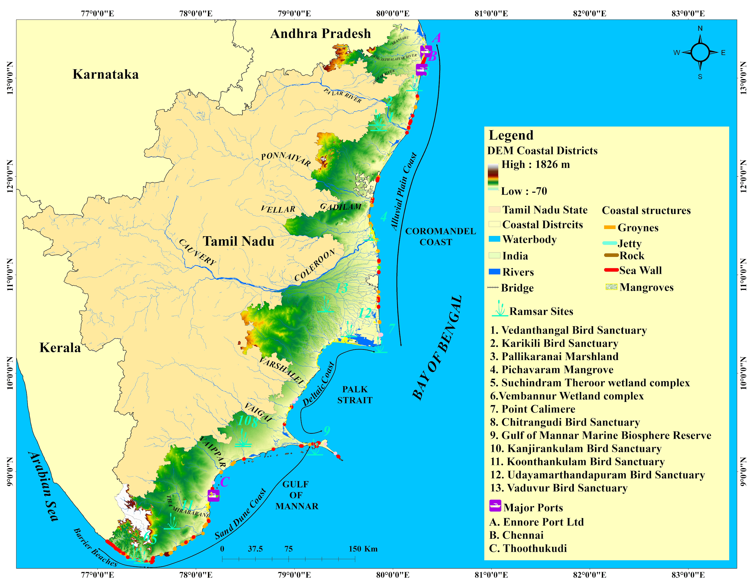
Source: Climate Risk Country Profiles
- Tamil Nadu sits at the southeastern tip of India.
- It is bordered by Andhra Pradesh, Karnataka, Kerala, and the Bay of Bengal.
- Its coastline has grown from 906.9 km to 1,068.69 km.
- This makes Tamil Nadu have the second-longest coastline in India, ahead of Andhra Pradesh.
- The region is known for the Coromandel Coast and is a key centre for fishing and international shipping.
- It also plays a strategic role in linking India’s trade routes to Southeast Asia.
3. Andhra Pradesh
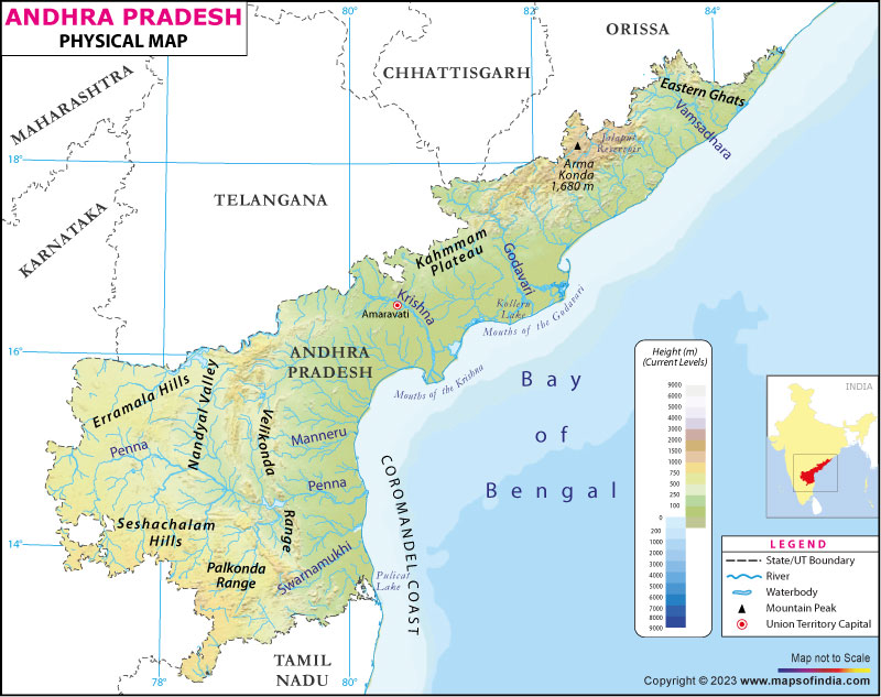
Source: India Map
- Andhra Pradesh is on the eastern coast next to the Bay of Bengal.
- It shares borders with Odisha, Chhattisgarh, Telangana, and Tamil Nadu.
- The coastline now measures 1,053.07 km, up from 973.7 km.
- Despite this increase, it is now ranked third in the country.
- This coastline plays a key role in India’s "Act East" policy.
- Visakhapatnam Port, an important hub for the Indian Navy and bulk trade, is located here.
- The region also has plenty of marine resources and natural gas.
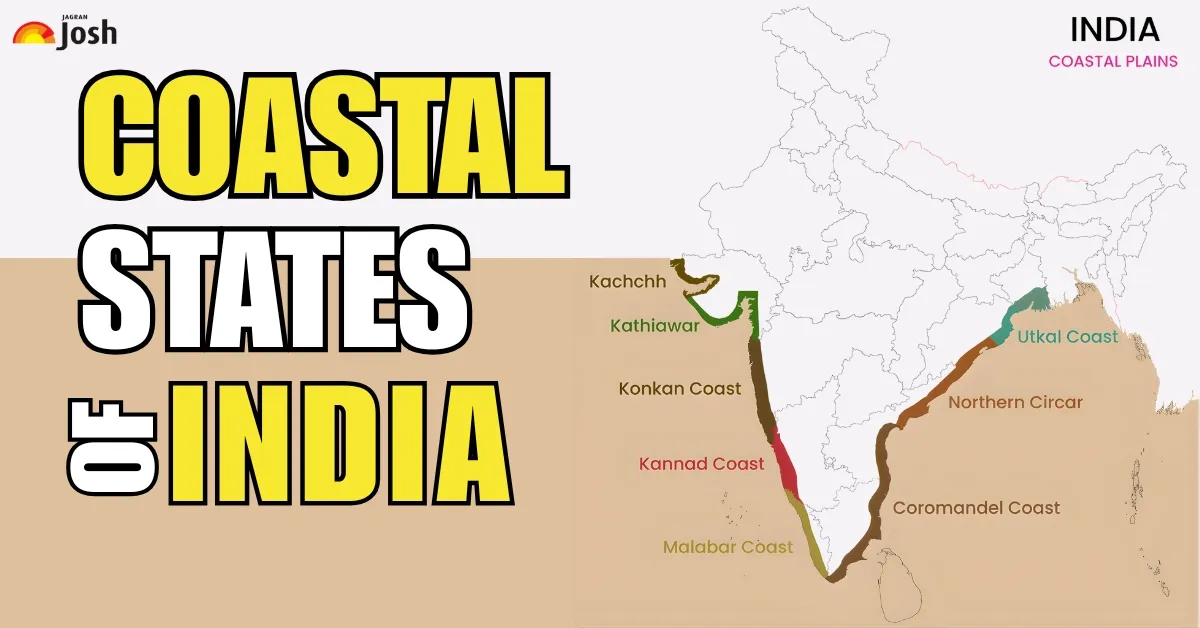
IN CASE YOU MISSED| Why Coromandel Coast Is Called The Coromandel Coast?
4. Maharashtra

Source: Research Gate
- Maharashtra lies along the Arabian Sea to the west.
- It is bordered by Gujarat, Madhya Pradesh, Chhattisgarh, Telangana, Karnataka, and Goa.
- The official length of its coastline was updated from 652.6 km to 877.97 km.
- The Konkan coast is known for its rugged beauty, with rocky cliffs and sandy beaches.
- The area is important to India’s economy, as it includes the major Mumbai and JNPT ports.
5. West Bengal

Source: Research Gate
- West Bengal lies in eastern India along the Bay of Bengal.
- It shares borders with Odisha, Jharkhand, Bihar, Sikkim, and Bangladesh.
- The state’s coastline increased from 157.5 km to 721.02 km because of the many islands and rivers in the Sundarbans mangrove forest.
- This coastline is important for protecting the environment and managing disaster risks.
- It helps shield the region from cyclones and supports a unique ecosystem known around the world.
6. Kerala
- Kerala is a narrow stretch of land in southwest India, next to the Arabian Sea.
- It shares borders with Karnataka and Tamil Nadu.
- The coastline has grown a bit, from 569.7 km to 600.15 km.
- Called the Malabar Coast, this area is well known for its backwaters and long history in the spice trade.
- The coast plays a key role in India’s fishing industry and tourism.
7. Odisha
- Odisha is on the eastern coast of India, next to the Bay of Bengal.
- It shares borders with West Bengal, Jharkhand, Chhattisgarh, and Andhra Pradesh.
- The length of its coastline was recently updated from 476.4 km to 574.71 km. This area, called the Utkal Plains, often faces cyclones.
- Having a more accurate map of the coast helps save lives by improving disaster management and making it possible to build stronger seawalls.
- The coast also has Paradip Port, which handles large shipments of iron ore and coal.
8. Karnataka
- Karnataka lies on the western coast by the Arabian Sea.
- It shares borders with Goa, Maharashtra, Telangana, Andhra Pradesh, Tamil Nadu, and Kerala.
- The coastline has increased from 280 km to 343.3 km.
- This stretch, called the Kanara coast, is famous for its beaches and temple towns.
- The region plays a key role in maritime trade through the New Mangalore Port.
9. Goa
- Goa is India’s smallest coastal state on the western shore.
- It is bordered by Maharashtra and Karnataka.
- Its coastline has grown from 160.5 km to 193.95 km.
- Even though it is small, Goa is famous worldwide for its beaches and nightlife.
- The updated coastline helps manage busy beaches and protect unique features like sea caves and cliffs.
- It also benefits Mormugao Port, an important hub for iron ore exports and cruise ships.
10. Andaman & Nicobar Islands (UT)
- These islands sit far out in the Bay of Bengal and share maritime borders with Myanmar, Thailand, and Indonesia.
- Their coastline has grown from 1,962 km to 3,083.50 km.
- This makes it the longest of any Indian territory.
- Often called India’s "sentinels" in the east, the islands provide a large Exclusive Economic Zone (EEZ) and help India keep watch over the busy Malacca Strait shipping route.
11. Lakshadweep (UT)
- Lakshadweep is a group of coral islands in the Arabian Sea, located to the west of Kerala.
- The Maldives is its closest neighbour.
- The total coastline has grown from 132 km to 144.8 km.
- These islands play a key role in India’s strategic position in the Indian Ocean.
- They allow the Indian Navy and Coast Guard to keep watch over shipping routes between Asia and the Middle East.
12. Puducherry (UT)
- Puducherry is a Union Territory made up of four small coastal districts in South India.
- It is almost entirely surrounded by Tamil Nadu and Andhra Pradesh.
- The coastline has grown from 30.6 km to 42.65 km.
- Puducherry is known for its blend of French and Indian culture and is a popular spot for spiritual tourism.
- The coast is important for local fishing families and the tourism industry.
MUST READ| Which is the only Sea without any Coastlines?
Why Has India’s Official Coastline Length Increased Recently?
India’s official coastline length changed because our way of measuring it improved. Earlier, maps did not show as much detail.
Today, the National Hydrographic Office and Survey of India use high-resolution satellites and modern GIS software.
These tools can spot every small curve, creek, and inlet that older maps missed. Since the new measurement includes these intricate details, the total length increased from 7,516.6 km to 11,098.81 km.
How Does This New Data Help India's Maritime Security?
The new data brings major improvements for the Indian Navy and Coast Guard. Here’s how it makes a difference:- Better Patrolling: With more accurate maps of hidden creeks and islands, the Coast Guard can keep a closer watch on places where smugglers or intruders might hide.
- Defining Borders: The data helps India clearly mark its Exclusive Economic Zone (EEZ). This protects our fishing rights and underwater resources, such as oil and gas, from other countries.
- Search and Rescue: If there is an accident at sea, high-resolution data helps rescue teams find locations faster and move safely through tricky coastal areas.
- Disaster Preparedness: Because the new data tracks the High-Water Line (HWL), the government can better predict which areas might flood during a cyclone and evacuate people more quickly.


Comments
All Comments (0)
Join the conversation