Show Key Points
The Western Pacific has birthed a meteorological monster as Super Typhoon Sinlaku exploded into a Category 5-equivalent storm on Monday, April 13, 2026. According to the Joint Typhoon Warning Center (JTWC), Sinlaku is currently packing sustained winds of 180-185 mph, with terrifying gusts topping 220 mph.
This rapid intensification has made Sinlaku the second-strongest typhoon ever recorded so early in the calendar year. Positioned roughly 300 miles southeast of Saipan, the storm is tracking northwestward, placing U.S. territories under immediate threat of catastrophic wind damage, 20-foot storm surges, and up to 20 inches of rainfall.
What is the Current Path and Intensity of Super Typhoon Sinlaku?
Meteorologists are keeping a close eye on Sinlaku's pinhole eye, which is a sign of very strong tropical systems. The storm is currently moving through a high-energy area with sea surface temperatures of 29°C and low wind shear, which is keeping it at its strongest longer than expected.
Super Typhoon Sinlaku Update (As of April 13, 2026)
| Metric | Status/Value |
| Max Sustained Winds | 185 mph (295 km/h) |
| Peak Gusts | 220 mph (355 km/h) |
| Central Pressure | 897 hPa |
| Movement | Northwest at 9 mph |
| Storm Category | Category 5 (Super Typhoon) |
The latest track from the National Weather Service (NWS) in Tiyan indicates a potential direct hit or near-miss passage between Rota, Tinian, and Saipan. Even a slight shift in the track could bring the most destructive eyewall winds directly over the most populated areas.
Also Read - America's Hurricane History: Check List of the Most Impactful Storms
How is the U.S. Preparing for the Category 5 Typhoon Impact?
Authorities in the Commonwealth of the Northern Mariana Islands (CNMI) and Guam have moved into high-alert status. Governor Arnold Palacios has declared a State of Emergency, urging residents to complete all heavy-weather preparations before nightfall on Monday.
-
Typhoon Warnings: Currently in effect for Saipan, Tinian, and Rota.
-
Tropical Storm Warnings: Issued for Guam, where the outer bands are already causing flight cancellations at Antonio B. Won Pat International Airport.
-
Emergency Shelters: Public schools and government buildings have transitioned into storm shelters to accommodate thousands of residents living in non-concrete structures.
Official sources from Guam Homeland Security warn that Sinlaku’s massive wind field extends nearly 400 miles from the center, meaning that even if the eye stays offshore, the islands will experience hurricane-force conditions.
Also Read - List of Retired Hurricane Names by WMO (Updated)
Is Sinlaku Setting Records for April Typhoons?
The emergence of a Category 5 super typhoon in mid-April is an atmospheric anomaly. In the past, the Western Pacific has been pretty quiet in April. Sinlaku is already stronger than most storms that happen before the season starts, and people are comparing it to the deadly Typhoon Mawar of 2023.
If the eye hits land on Guam or the CNMI at its current strength, it will be the first recorded Category 5 April landfall in the region's history. This shows how storms are getting stronger because the ocean is getting warmer.
Check Out - How do Hurricanes Get Their Names?
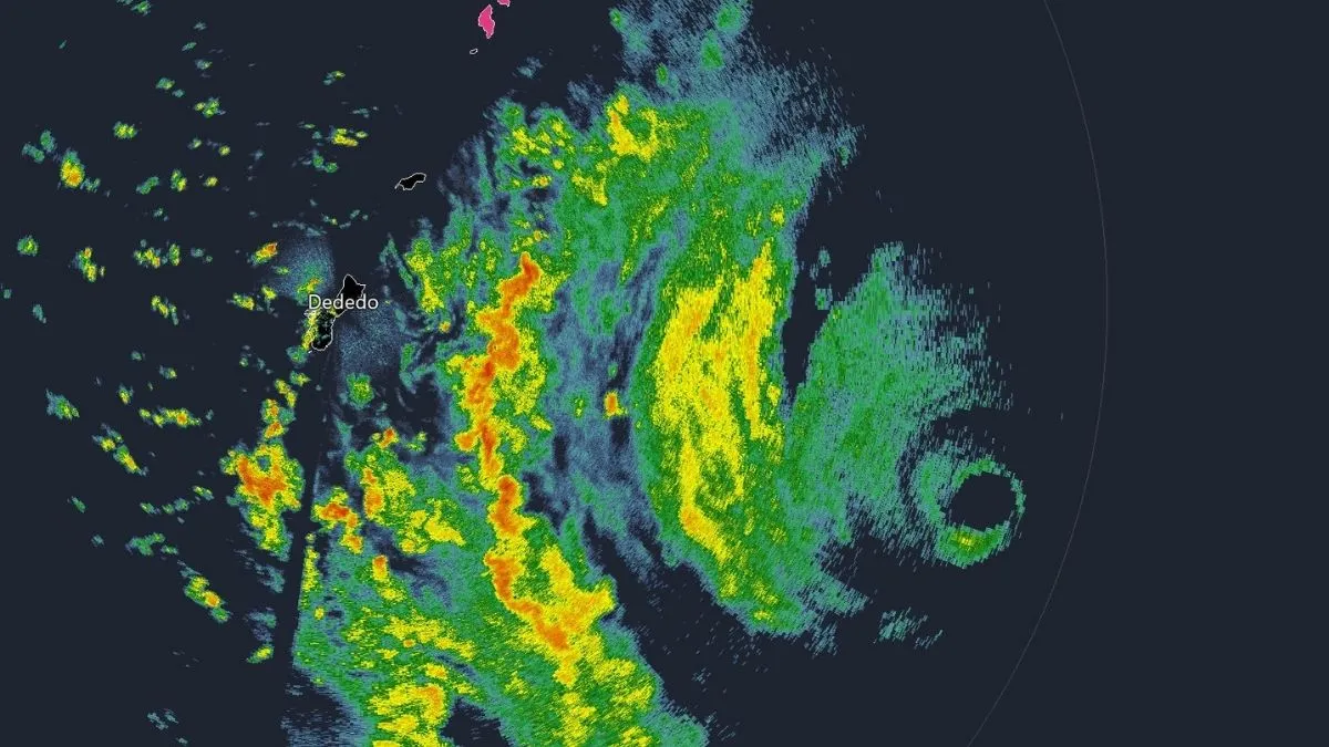
Super Typhoon #Sinlaku is now equivalent to a 175 mph Category 5 in the western Pacific. What a beast. Note Guam on the left side of the image, which will be feeling local impacts especially into Tuesday. pic.twitter.com/bA4VU4jwGn
— Matt Devitt (@MattDevittWX) April 12, 2026
Super Typhoon Sinlaku remains a life-threatening system as it approaches the Marianas. Residents must put safety first and do what local emergency management tells them to do. Sinlaku's record-breaking wind speeds and historic timing are a stark reminder of how unpredictable the 2026 typhoon season will be.


Comments
All Comments (0)
Join the conversation