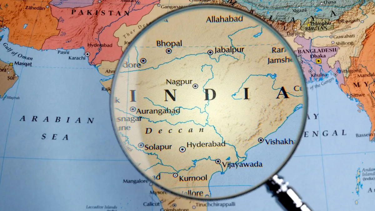
Southernmost Point of India: The southernmost point of India is Indira Point, located on Great Nicobar Island in the Andaman and Nicobar Islands (Union Territory). Situated at 6°45′ N latitude, Indira Point marks the last point of the Indian landmass extending deep into the Indian Ocean. It is India’s final boundary to the south and a key geographical landmark symbolising the country’s maritime strength.
Where is Indira Point Located?
Indira Point lies in the Nicobar District of the Andaman and Nicobar Islands, approximately 650 km from Port Blair and about 150 km north of Sumatra (Indonesia). Surrounded by the Bay of Bengal and the Indian Ocean, it serves as a vital link between India and Southeast Asia. This point holds strategic and environmental importance, as it lies close to major international shipping lanes and within India’s Exclusive Economic Zone (EEZ).
History and Origin of the Name
Indira Point was earlier known as Pygmalion Point until it was renamed in 1985 to honour Prime Minister Indira Gandhi. The renaming was done after her visit to the islands, recognising her contribution to national unity and development. A lighthouse, established in 1972, stands at Indira Point, guiding ships navigating through the Indian Ocean. It continues to function even after surviving natural calamities like the 2004 tsunami.
Biodiversity and Ecology of Great Nicobar Island
The island that hosts Indira Point is part of the Great Nicobar Biosphere Reserve, recognised by UNESCO for its ecological significance. The region is home to tropical rainforests, mangroves, coral reefs, and rare species such as Nicobar Megapode (Megapodius nicobariensis), Saltwater Crocodiles, giant Leatherback Turtles, the Nicobar Tree Shrew, Endangered bird and butterfly species.
Interesting Facts About Indira Point
1. Southernmost Point of Indian Territory
Indira Point is officially the southernmost point of India, located on Great Nicobar Island. It extends India’s geographical reach into the southern Indian Ocean, symbolising the nation’s territorial completeness.
2. Named After Indira Gandhi
It was renamed Indira Point in 1985 in memory of Prime Minister Indira Gandhi, who had a deep interest in India’s remote islands and border regions.
3. The Lighthouse Landmark
The Indira Point Lighthouse, constructed in 1972, continues to guide international maritime traffic in the Andaman Sea and Indian Ocean. It is maintained by the Directorate General of Lighthouses and Lightships.
4. Closest Indian Point to Indonesia
Indira Point lies just 150 km from Sumatra Island in Indonesia, making it India’s closest land point to another country in Southeast Asia. It plays a vital role in India-Indonesia maritime relations.
5. Partly Submerged After Tsunami
Following the 2004 tsunami, Indira Point’s ground level dropped, submerging part of its coastline. However, it remains a powerful symbol of India’s resilience and geographical significance.
6. Ecological Importance
It lies within the Great Nicobar Biosphere Reserve, home to several endemic plant and animal species. The region supports dense tropical forests, mangrove ecosystems, and marine biodiversity.
7. Restricted but Scientifically Valuable
Though closed to tourists, Indira Point serves as a research and observation site for geologists, marine biologists, and climate scientists studying tectonic movements and climate impacts.
Read more: Which is the Only City in the World That lies on Two Continents?


Comments
All Comments (0)
Join the conversation